ALASKA HIGHWAY
Dawson Creek, BC
to Delta, Alaska
YUKON
Map with
Hwy links
Kluane Lake area
Campbell Hwy
Dempster Hwy
Dawson City
Klondike Hwy-North
Klondike Hwy-South
Haines Road
Nahanni Range Rd
Silver Trail
South Canol Road
Top of the World
Hwy
BEARS
Grizzly
/ Black
WILDLIFE
BIRDS
NORTHERN LIGHTS
ALASKA
Taylor Hwy
Denali National Park
McCarthy Road
Richardson Hwy
and more
BRITISH COLUMBIA
Cassiar Highway
Liard Hot
Springs
PLAN YOUR TRIP
Planning Links
Campgrounds/POIs
YUKON sights
2020
2019
2017
2016
2015
2014
2013
2012
2011
RV BLOGS
Vancouver Island
to Yukon & Alaska
2010 Aug & Sept
2009 September
2008 June
2007 September
2001 December
2000 August
1998 December
1997 September
1993 September
Lac La Hache to Pemberton BC on Hwy 97 and 99
17 September 2009 - Thursday
This adventure north and meandering through BC had been very relaxing. We had not driven Hwy 99 between Hwy 97 and Vancouver for many years and decided it was a good day for that. The Horseshoe Bay ferry terminal is on the north side of Vancouver.
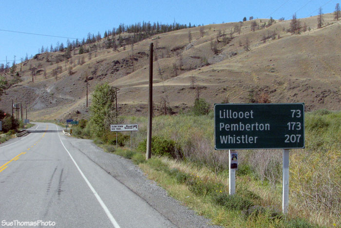
Turning off Hwy 97 onto Hwy 99 headed westbound
Marble Canyon Provincial Park is about 30km from Hwy 97. Unlike most provincial park campgrounds, Marble Canyon was not well suited for larger units. It was a bit tight, but we found a spot for lunch.
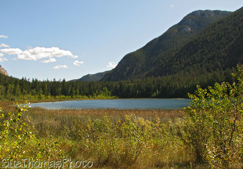
Turquoise Lake at Marble Canyon Provincial Park
There were numerous birds making use of Crown Lake, which is visible from the campground and has a trail right to it. This heron caught my eye as it strolled through the shallows.
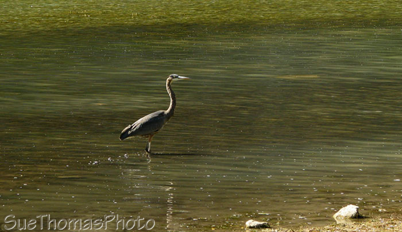
Heron wading in Crown Lake near Marble Canyon
Back on the road, the landscape started to change from grassland to mountains. There were numerous farms & ranches along the route, taking advantage of every bit of land.
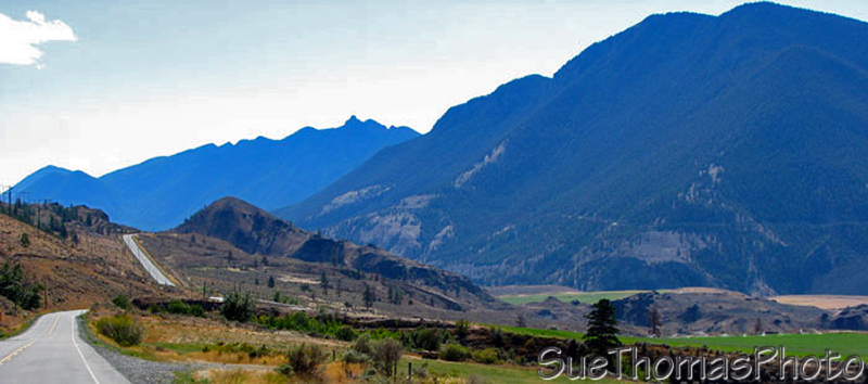
Hwy 99 westbound between Marble Canyon and Lillooet
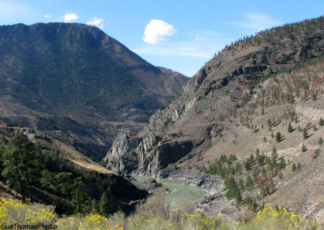
It is not too long before the Fraser River joins the route, along with BC Rail and BC Hydro lines.
Fraser River alongside Hwy 99
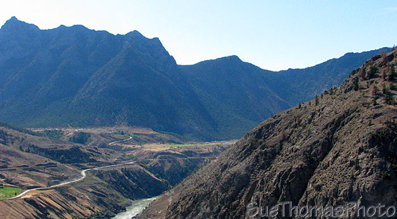
The Fraser River has deeply etched the canyon. The scenery is entertaining, for sure!
Fraser River
Rail overpass ... timing is everything! Also note the hydro lines above.
Rail crossing over Hwy 99
To get to Lillooet and continue on Hwy 99, you must make a right turn away from Highway 12 to cross a bridge over the Fraser River. If you want to go into Lillooet, follow the signs. We continued on along Hwy 99 without stopping to sightsee. Soon after leaving Lillooet, the Power Canal bridge gives the first indication of what future bridges might be like.
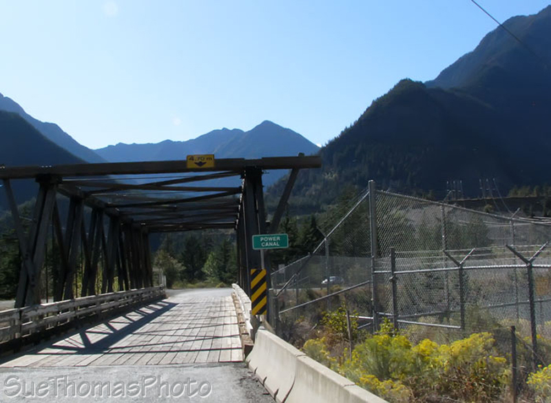
Power Canal bridge, near Seton Lake Reservoir
After passing Seton Lake, the highway immediately begins to climb.
Leaving Lillooet heading upwards and westward towards Pemberton
The highway is generally in good condition with lots of twists, turns and ups & downs as it crawls into the coastal mountains towards Pemberton. Do be sure your vehicle is in good condition with lots of coolant in the radiator!
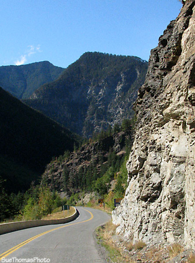
Approaching the coastal mountains
What goes up, must come down.
A sign of things to come ...
Duffey Lake has several places to stop alongside it. We didn't stop as most of those places were occupied by tour buses! So I resorted to clicking pics out the window.
Duffey Lake, looking eastward back towards Lillooet
Don't quote me on it, but I believe the next picture is of Mount Howard, Mount Matier, & Joffre Peak with the Anniversary Glacier and Twin One Glacier .
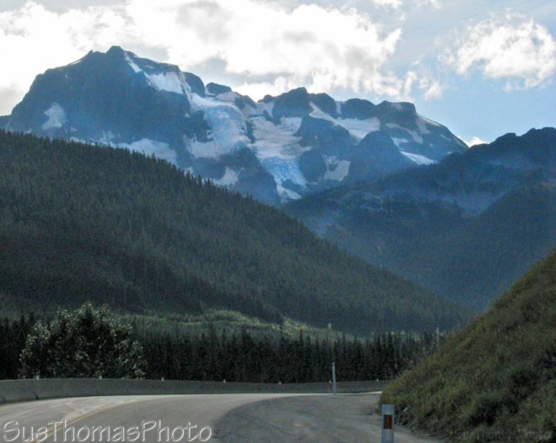
Glaciers viewed westbound on Hwy 99
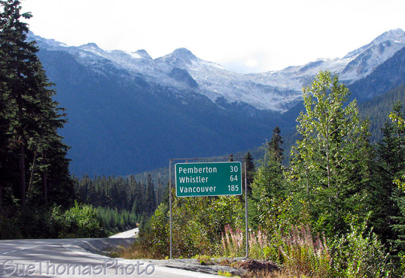
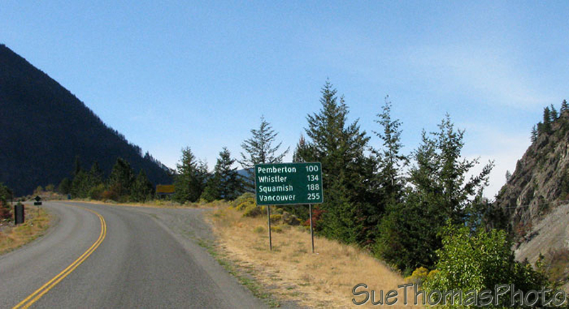
70 km behind us and 30 left to go!
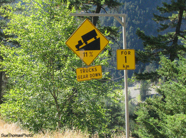
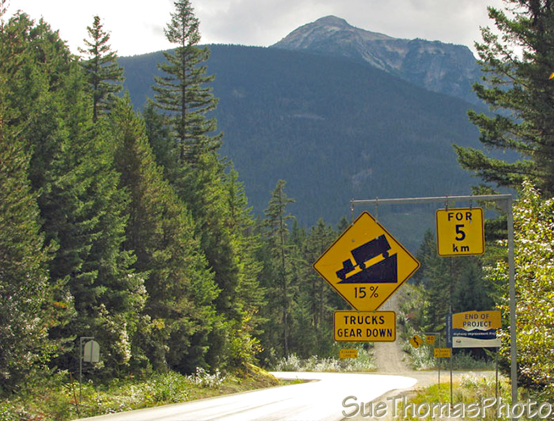
Another 11% grade but interestingly there is no indication of how long the 11% grade is. Seems our memories were a lot shorter than the hill ...
Start of 11% downhill grade westbound on Hwy 99
According to the GPS, the above photo was taken at an elevation of 1005m. The next photo was taken 6 km later at an elevation of 555m. So, a decline of about 450m over 6,000m. It wasn't 11% downhill all the way, but steep enough in places for the brakes to get hot.
There is a small pullout at the spot pictured below. We stopped to let the brakes cool. Were also happy to have disc brakes all around on the truck. The truck brakes were really working to take the load as the trailer brakes were smoking hot and not effective.
Waited patiently for 15 minutes, swallowed hard, then headed on down the road again.
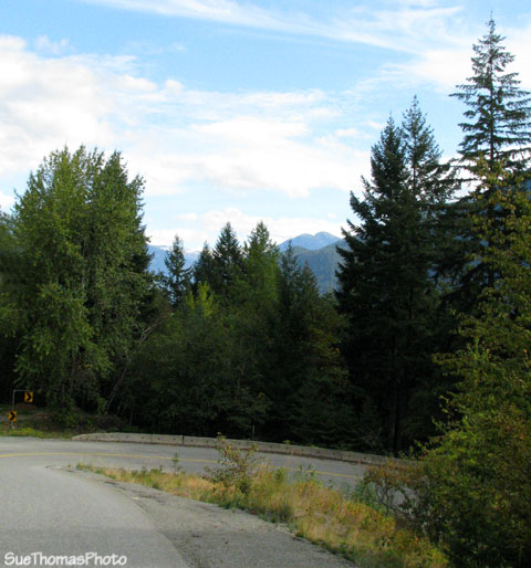
Stopped at a pull out to let the brakes cool down & debate the next
5 km
The GPS tracked our movements, as it had from day one. According to the GPS, the brake check stop pictured above was at an elevation of 555m.
Hairpin turns included!
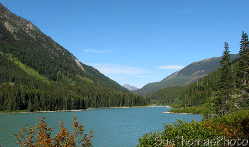
During the next 12 minutes (during which we held our breath) we dropped to an elevation of 220m at Lillooet Lake & the Birkenhead River, which you can see in the photo below.
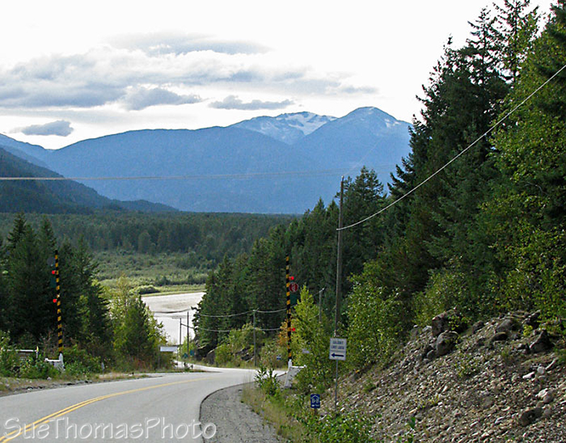
The END is in sight!
Finally, we hit bottom! It was a relief! The truck brakes were smelling strong, but still working. It received much praise for a job well done! BUT, in the world according to Garmin, it was ONLY 3.5 km, not the 5 km posted at the brake check pullout. 335m over 3,500m ... not quite 10%. Is there something wrong with my math? This is the profile of this section of highway, extracted from the GPS track properties. The top is the brake check and the bottom is the river.
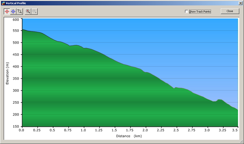
Profile of the section of road between the brake check area to the
bottom of the hill at the river
The Pemberton Valley is a pleasant drive. Nairn Falls Provincial Park was open for camping, with half the campground closed because it was late in the camping season. It was our first time here and our last night on the road. Rather than start a campfire for the evening, we just sat around the truck's brakes for warmth ... kidding!
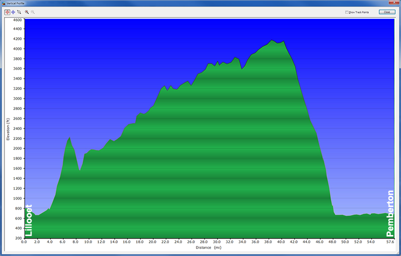
Here is the profile from the GPS for the full distance from Lillooet to Pemberton, showing altitude in feet and distance in miles for those who speak Imperial rather than Metric.
Previous Page - 16 September 2009
Next Page - 18 September 2009