ALASKA HIGHWAY
Dawson Creek, BC
to Delta, Alaska
YUKON
Map with
Hwy links
Kluane Lake area
Campbell Hwy
Dempster Hwy
Dawson City
Klondike Hwy-North
Klondike Hwy-South
Haines Road
Nahanni Range Rd
Silver Trail
South Canol Road
Top of the World
Hwy
BEARS
Grizzly
/ Black
WILDLIFE
BIRDS
NORTHERN LIGHTS
ALASKA
Taylor Hwy
Denali National Park
McCarthy Road
Richardson Hwy
and more
BRITISH COLUMBIA
Cassiar Highway
Liard Hot
Springs
PLAN YOUR TRIP
Planning Links
Campgrounds/POIs
YUKON sights
2020
2019
2017
2016
2015
2014
2013
2012
2011
RV BLOGS
Vancouver Island
to Yukon & Alaska
2010 Aug & Sept
2009 September
2008 June
2007 September
2001 December
2000 August
1998 December
1997 September
1993 September
Atlin BC to Whitehorse Yukon via the South Klondike Hwy
30 August 2009 - Sunday
The morning was bright and the lake calm.
Looking north on Atlin Lake from Warm Bay
Looking west over Atlin Lake from Warm Bay Recreation Site
Looking east from Warm Bay hot spring area
Back on Atlin Road headed north to Tagish.
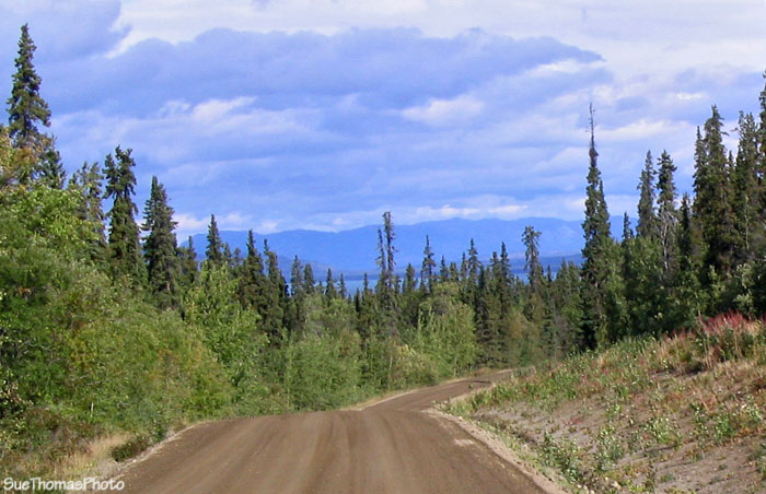
Atlin Road northbound in B.C.
At the Yukon/B.C. border there are numerous signs reminding people they are moving from one jurisdiction to the other.
Near the B.C./Yukon border northbound
The longest & steepest decline northbound, looking towards little
Atlin Lake
At the north end of the Atlin Road, the sign makes it clear which way is which.
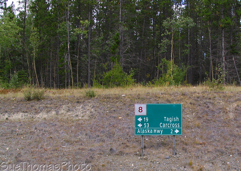
At the end of the Atlin Road, this sign gives
some options
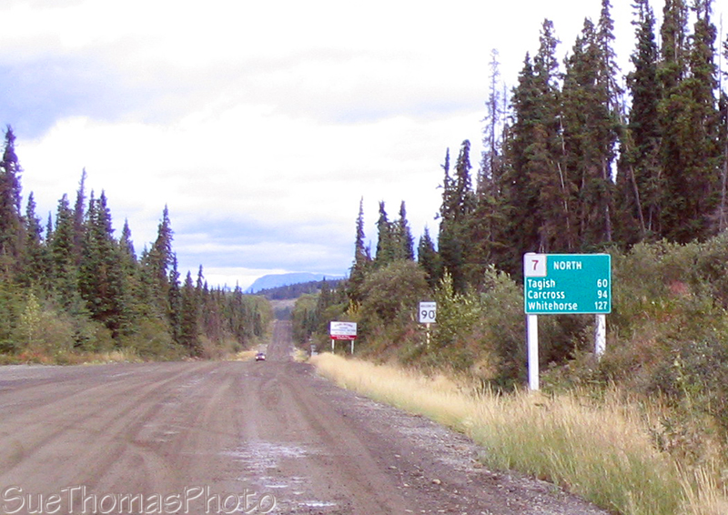
We turned towards Tagish & Carcross.
Looking north from the bridge crossing the Tagish River
At Carcross, we continued south on the Klondike Highway as the weather was nice.
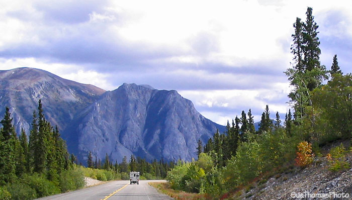
Southbound on the South Klondike Highway
just south of Carcross
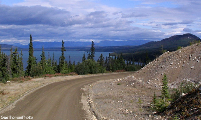
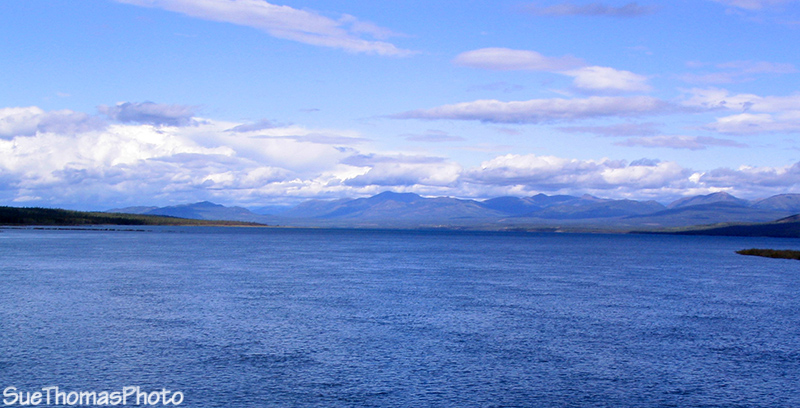
There's a viewpoint above Bove Island; well worth the stop!
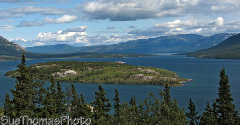
Bove Island
Tagish Lake
Returning northbound on the South Klondike Highway to Carcross ...
Approaching Carcross
After a quick tour of Carcross, we continued north on the Klondike Highway.
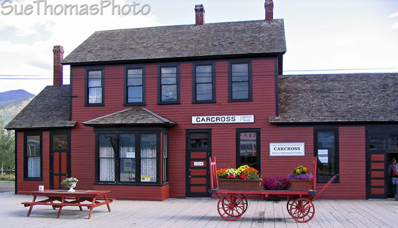
Historical rail station in Carcross
Looking south at the exit from Carcross onto the South Klondike
Highway
Unfortunately, Emerald Lake was not in its brilliant colours as the sun was being shy.
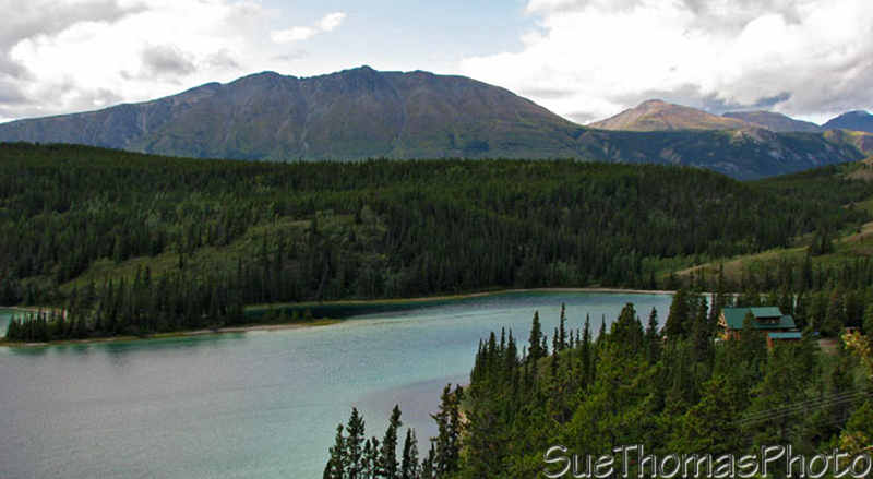
Emerald Lake
We carried on towards Whitehorse and our overnight camp spot.